Ikei-jima
伊計島Ichi26°23′ N 127°60′ ECentral Okinawaend of the roadfarmlandbeaches
Ikei-jima is the last island on the road from the Kaichu Doro in Uruma, and the 198 m Ikei Ohashi from Miyagi carries you onto its flat 1.72 km² of farmland. Its 247 residents live in one village on the south side, and Ikei Beach and Odomari Beach on the west coast draw summer swimmers.
Photo Opqr · Wikimedia Commons · CC BY-SA 3.0 and others, credited in the gallery
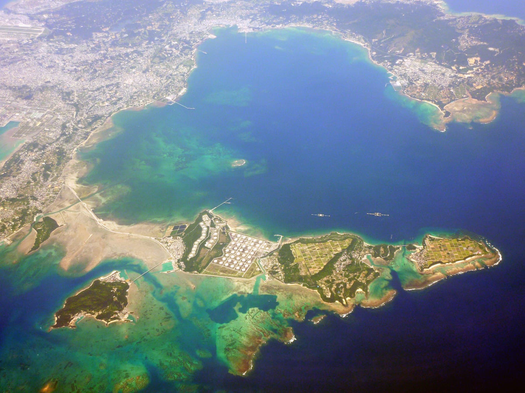
Ikei is a limestone shelf about 2 km long, mostly flat at around 25 m and ringed by sea cliffs about 20 m high except on the east side. Its single village faces south toward the bridge, and the rest of the island is farmland reorganized into neat blocks after land improvement began in 1979. Sugarcane is the main crop, and Uruma's tourism association also points to the island's golden sweet potato. A fixed-net fishery off the north-west coast is known for bonito.
Uruma calls the Nakabaru site the largest pit-dwelling site in the prefecture. It became a national historic site in 1986, and the city has reconstructed part of a village that stood here about 2,500 years ago. At the south-west tip the Ikei gusuku stands on a limestone stack that was an island of its own until a sandbar joined it to Ikei. Villagers once climbed about 150 stone steps down the cliff to the Innagaa spring for their water, and a ryuka verse survives in which a young woman wonders whether to marry onto an island with such a climb.
The old school became the Okinawa Ikei campus of N High School in 2016. Uruma's tourism association warns that the currents around Ikei run fast, and the Fuukijiru channel between Ikei and Miyagi is known for its strong tidal flow.
Getting there
Ikei is the last island on the road: cross the Kaichu Doro to Henza, carry on over Miyagi and take the 198 m Ikei Ohashi, which opened on 1 March 1982. Uruma City's paid local bus runs out to the islands from the Yakena area.
Getting around
The island measures about 2 km end to end, so a bike covers it easily. The one village sits on the south side near the bridge, and the beaches lie along the west coast.
Riding on Ikei-jima
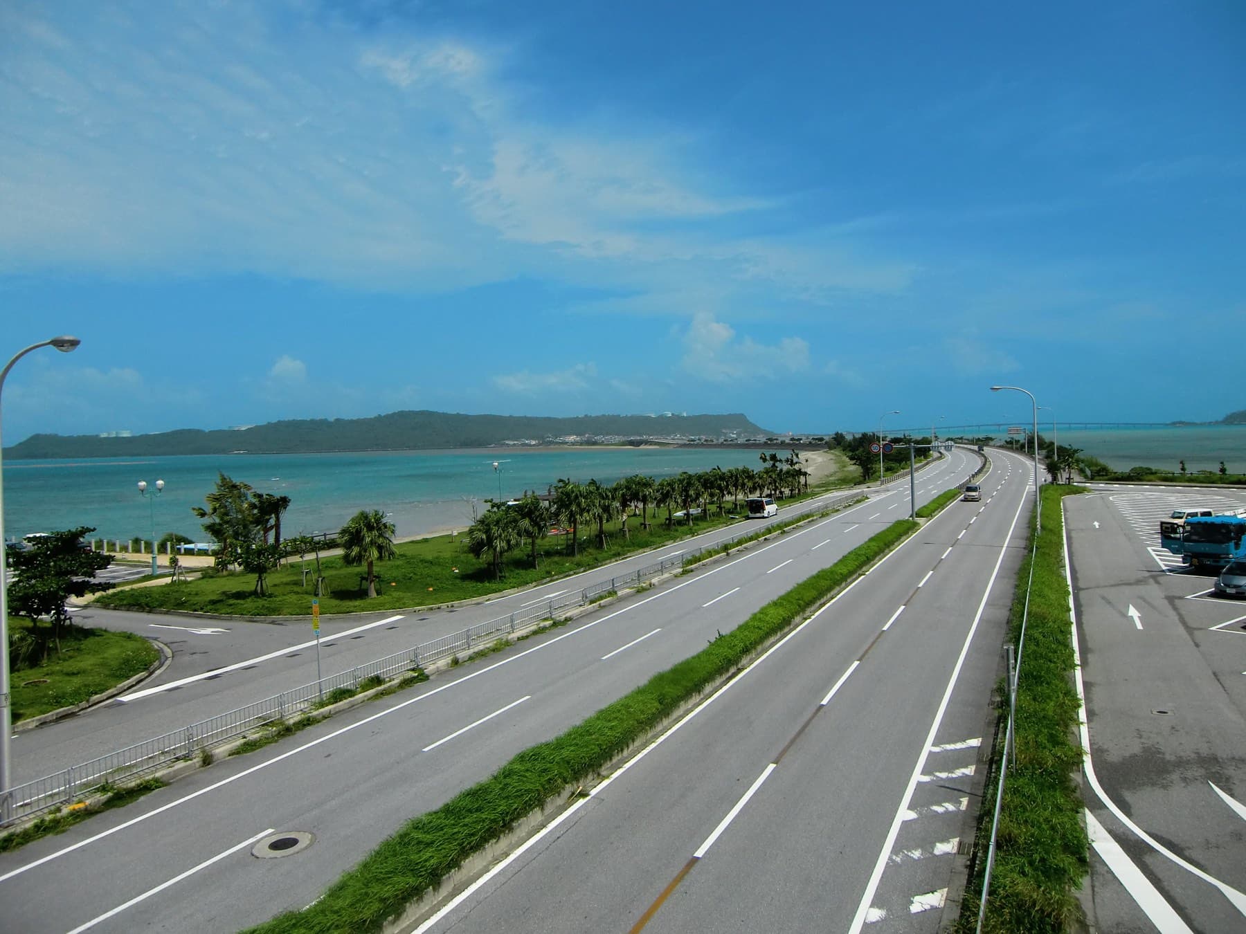
The red Ikei Ohashi carries the road onto the island, which sits mostly at about 25 m on a flat limestone shelf. Lanes run between squared-off cane fields to the beaches on the west coast and the Nakabaru site in the middle. Ikei makes the natural turning point for a ride out from Umino Eki Ayahashi-kan.
Sea Kayak Okinawa Kamome no Jonathan rents cross bikes and e-bikes from its Kaichu Doro boathouse opposite Umino Eki Ayahashi-kan; see the Henza page for prices.
December to March
From December to March the north-east monsoon blows across this flat, exposed island with little to stop it. Sea temperatures stay around 21–23 °C.
Worth knowing
- Ikei Beach and Odomari Beach on the west coast are the places to swim; outside them the currents around the island run strong.
- The Nakabaru site sits a little west of the island's centre, close enough to the road for a quick stop on the bike.
1 route
Ride Ikei-jima走る
FAQ
Quick answers about Ikei-jimaよくある質問
Can you drive to Ikei Island?
Yes. Ikei-jima connects to Miyagi by the 198 m Ikei Ohashi, opened in 1982, and Miyagi connects through Henza to the Kaichu Doro and the Okinawa main island. Ikei is the last island on that road.
How many people live on Ikei Island?
About 250. Uruma City's resident register counted 247 people in Ikei on 31 May 2021, all in one village on the south side of the island.
Where can you swim on Ikei Island?
Ikei Beach and Odomari Beach on the west coast are the swimming beaches on Ikei-jima. Uruma's tourism association warns that currents around the island run fast, so swim inside the beach areas.
How do you get to Ikei-jima?
Ikei is the last island on the road: cross the Kaichu Doro to Henza, carry on over Miyagi and take the 198 m Ikei Ohashi, which opened on 1 March 1982. Uruma City's paid local bus runs out to the islands from the Yakena area.
How big is Ikei-jima?
Ikei-jima covers 1.72 km² and is home to about 247 people.
Can you cycle on Ikei-jima?
The red Ikei Ohashi carries the road onto the island, which sits mostly at about 25 m on a flat limestone shelf. Lanes run between squared-off cane fields to the beaches on the west coast and the Nakabaru site in the middle. Ikei makes the natural turning point for a ride out from Umino Eki Ayahashi-kan.
What is Ikei-jima like in winter?
From December to March the north-east monsoon blows across this flat, exposed island with little to stop it. Sea temperatures stay around 21–23 °C.
Within 15 km
Stay nearby宿
Within 15 km
Eat and drink nearby食
Within 15 km
Beaches and swims nearby浜

Within 15 km
See nearby見る



Book it
Line up the trip around Ikei-jima
Some of these links pay us a commission. It costs you nothing and keeps the guide independent.